Our first big jeep rodeo

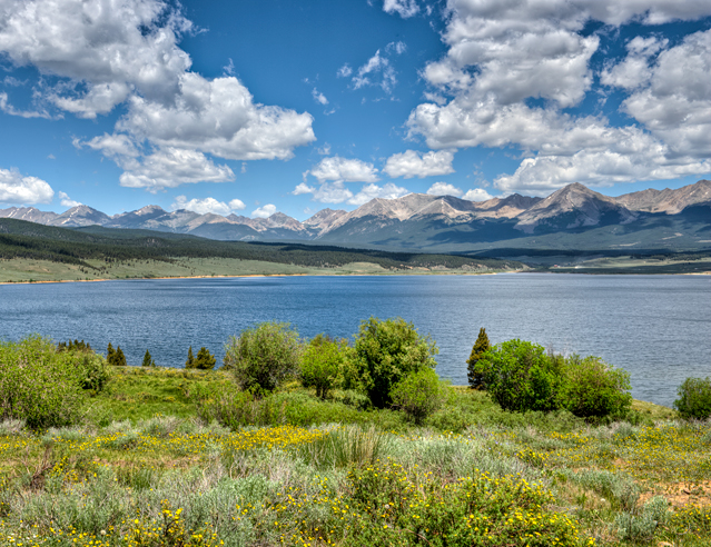
Taylor Reservoir, Colorado

July 1, 2013

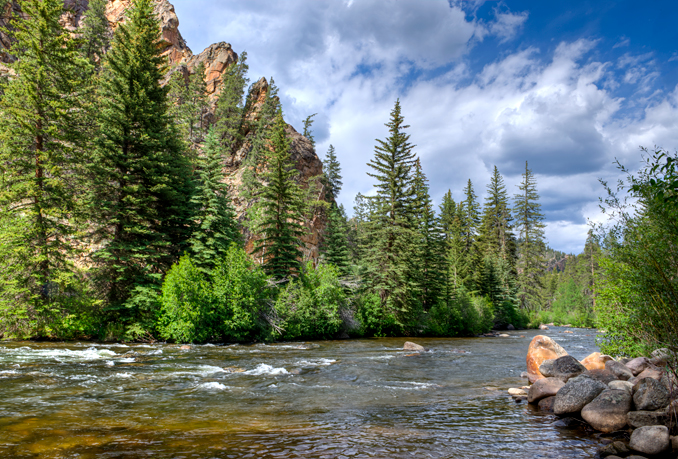
We took a ride along Taylor River in Gunnison National Forest.  It is a fly fisherman’s paradise and a rafter’s dream.  This is taken from the South End boat landing.

DSC_5245_6_7_2013-07-01-Taylor-River-South-Bank

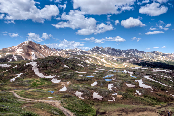
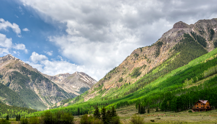
Here is a view of Taylor Reservoir looking north to the mountains on a perfect day.

DSC_5161_2_3_2013-07-01-Tayolr-Resv

County Road 752 took us up the Union Park area.  The dirt road was a breeze and no hint of the trouble to come.

DSC_5200_1_2_2013-07-01-Union-Camp-co-rd-752

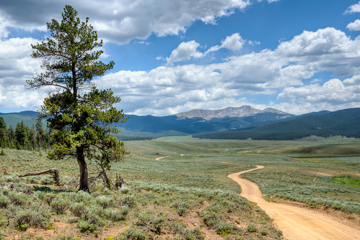
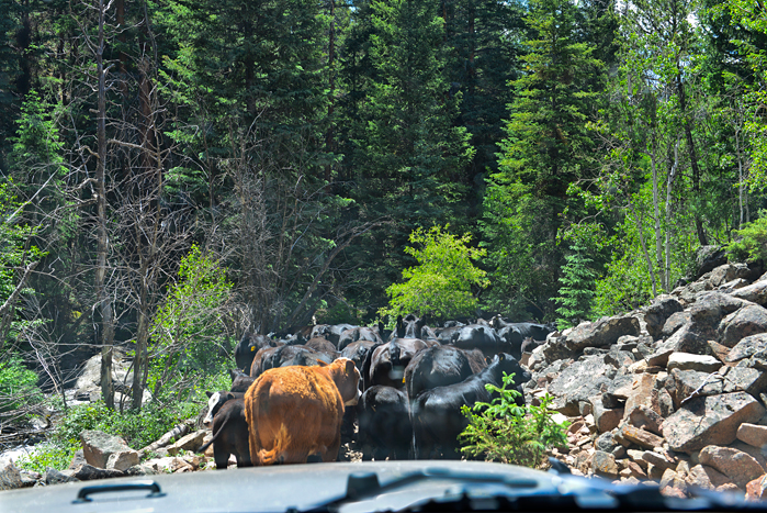
Our loop took us to the Lottis Creek trail which was increasingly narrow, rocky and blocked by cows.  The trail (such as it was) followed a talus slope and the meandering Lottis Creek.  We found ourselves in a very narrow bottleneck with a steep talus slope on one side and the rocky creek on the other with a herd of cows in front of us.  We used the jeep to move the herd out of our way for awhile but they had nowhere to go with the rest of the herd coming up the other way.  Eventually we found a spot to turn around and went out the way we had come.  I took this shot out of the jeep window before we found a spot to turn around.

DSC_5216-Lottis-Creek-talus-cow-jam


Posted in Colorado | Comments Off on Our first big jeep rodeo

Paradise Divide

Crested Butte, Colorado

June 21, 2013

The ride from Crested Butte up to Paradise Divide (11,350 elevation) was filled with magnificent views and gorgeous wildflowers.

This is a view of a large glacial pond at the Divide.  It was surrounded by the tiny golden glacier lilies.

DSC_4603_4_5_2013-06-21-Paradise-Divide

We met up with some jeep people who we followed on the Devil’s Punchbowl trail.  Here is the large two tiered waterfall that flows into the Crystal River.  After this point, we encountered a large boulder blocking the road as the trail ran with the river.  After trimming a few shrubs we had a way around.  The next obstacle was Crystal River and the river crossing was too swift and deep a flow for our constitution.

DSC_4682_3_4_2013-06-21-CB-Crystal-River-Falls-crop

The lupines are in bloom by the acres and what better way to enjoy them but from a well behaved trail horse.  They were saddled up and ready to ride.

DSC_4697_8_9_2013-06-21-Crested-Butte


Posted in Colorado | Comments Off on Paradise Divide

the alpine loop

Lake City, Colorado

June 14, 2013

The Alpine Loop Backcountry Byway, a network of four-wheel drive roads that connects Lake City, Ouray and Silverton, traverses passes up to 12,800 feet while showcasing  old mines, ghost towns, natural wonders, beautiful wildflower and abundant wildlife.  These roads were originally paths used by Native Americans crossing the region.  In the 1880s, these trails were widened and used to access mines.  Today was time to explore nature and history amidst thrilling views at breathtaking elevations.  We started in Lake City on Cinnamon Pass and headed back on Engineer Pass.

We were greeted with fields of wildflowers in the alpine tundra zone.  The alpine tundra has a short growing season.  This lovely meadow was near the Cinnamon Pass at 12,600 feet elevation.DSC_4245_6_7_2013-06-14-Cinnamon-Pass-alpine-tundra-flowers

This is a view from Engineer Pass Road as we are about to reach Engineer Pass at 12,800 feet elevation.

DSC_4254_5_6_2013-06-14-Engineer-Pass

Here is a view from Engineer Pass Rd looking back towards Ouray.

DSC_4275_6_7_2013-06-14-Engineer-Pass-Rd

Here is the required shot of the snow bank at the Engineer Pass.  A truly exciting ride that I cannot wait to do again and again.

DSC_4304-2013-06-14-Engineer-Pass-jeep-snow


Posted in Colorado | Comments Off on the alpine loop

Engineer Pass Road

Lake City, Colorado

June 13,2013

We traveled 12 miles of the historic Engineer Pass Road which was a major stagecoach and freight route when it was opened in the late 1870’s.  Like so many other mountain routes in the area, it was built by Otto Mears as a toll road.  Leaving from Lake City the road follows beautiful Henson Creek.

Capitol City is a ghost town found along this road.  It was founded in 1877 and had a population of 400.  It’s founders wanted it to become the capit0l of Colorado, hence the name.  Here are tw0 of the remaining log buildings along the trail.

DSC_4084_5_6_Engineer-Pass-Capitol-City-1877-2013-06-13

A view of Sunshine Peak from Capitol City.  The chalet is for sale if anyone is interested.

DSC_4103_4_5_Engineer-Pass-Capitol-City--crop-1877-2013-06-13

We took a side trip to Nellie Creek and spotted this 2 tier waterfall in a large aspen grove.  Yes, died and gone to heaven.

DSC_4146_7_8_Nellie-Creek-falls-crop

Posted in Colorado | Comments Off on Engineer Pass Road

the Carson ghost town

Carson, Colorado

June 11, 2013


We headed up Wager Gulch Trail to the ghost town of Carson.  The mining town was established in 1882 with an operating post office until 1903.  The ghost town is located at 11,500 feet elevation in a beautiful meadow surrounded by 14,000 ft mountains.  The town served the St. Jacobs Mine and others that produced gold, silver, lead, copper and zinc.  The few buildings that remain are only a tiny part of the town that, at one time, was large enough to straddle the Continental Divide.

A view of the ghost town as we approach:

DSC_3862_3_4_2013-06-11-Carson-Ghost-Town


the inside of the livery stable

DSC_3982_3_4_2013-06-11-Carson-Ghost-Town

one of the abandoned buildings that has been restored with a new roof and the jeep that brought us up to this amazing location:

DSC_3934_5_6_2013-06-11-Carson-Ghost-Town

Posted in Colorado | Comments Off on the Carson ghost town

the road to Animas Forks and other ghost towns

Animas Forks, Colorado

May 28, 2013

Our drive from Durango to the historic old mining town of Animas Forks took in many amazing Colorado vistas.

Stopping at the Rt. 550 overpass, we watched the morning stream train chuffing it’s way out of the Animas Valley of Durango.  It was filled with tourist heading to Silverton.

DSC_2665_DS-RR-overpass--text-crop-grad


This is a view from Molas Pass at 10,190 feet of elevation in the San Juan National Forest.  Molas Lake is in the background.

DSC_2683-Molas-Pass-crop


After leaving Silverton, we headed up scenic County Rd 2 to Animas Forks.  Along the was we followed the Animas River.  This old bridge shows the remains of a mining operation in these mountains.

DSC_2743_4_5_Amimas-Fork-soft


The town of Animas Forks was founded in 1875.  By 1885, the summer population has reached 450.  Few people braved the harsh winters at this elevation since many of the mines where shut down.  The town weathered the boom and bust cycles of mining until the 1920’s when the price of metals fell worldwide and began it’s slow transformation into the ghost town we see today.

DSC_2773_4_5_Amimas-Fork

Posted in Colorado | Comments Off on the road to Animas Forks and other ghost towns